Complete Property Overview - High Altitude Aerial
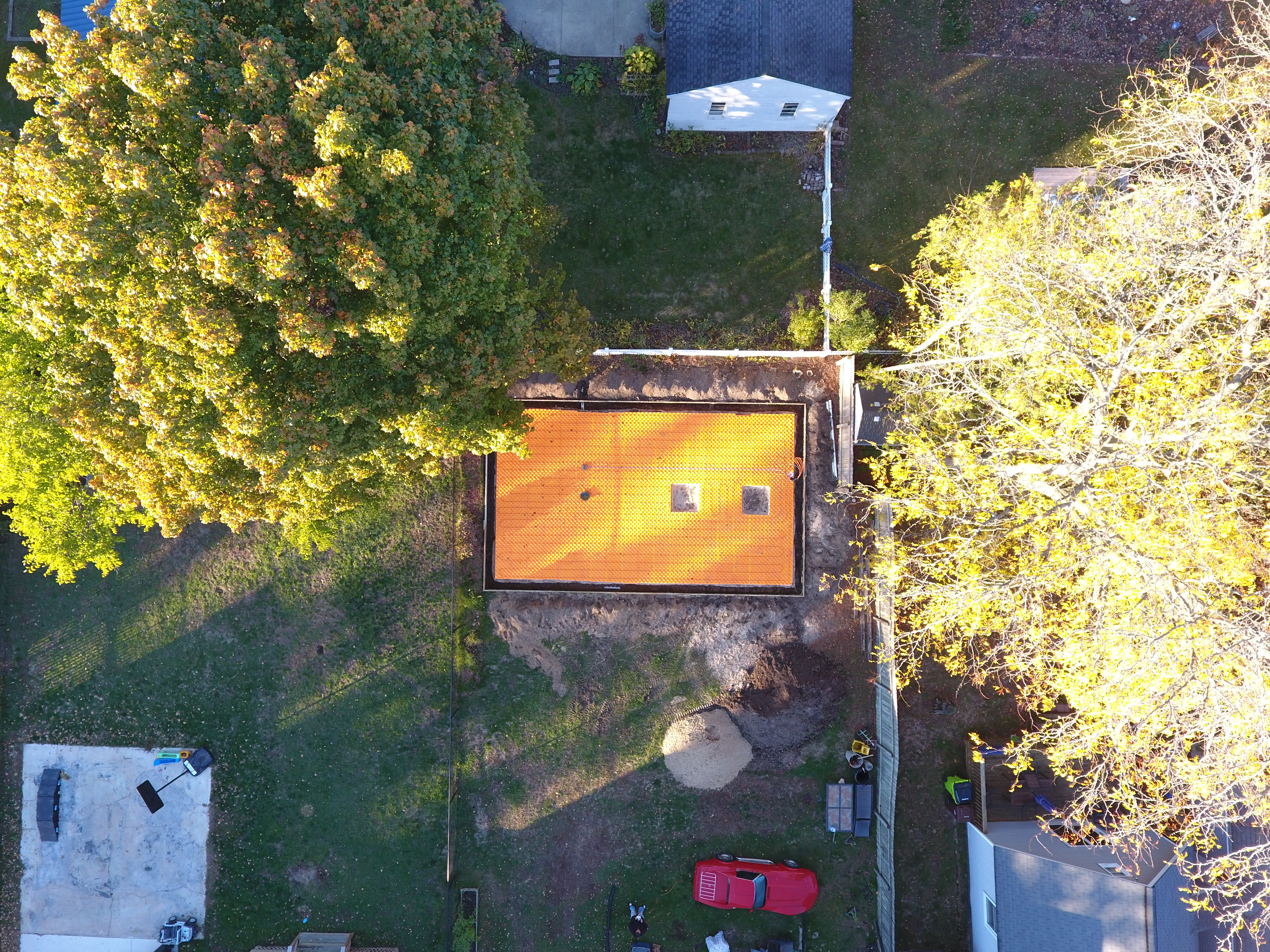
Photo Details
- Date: October 25, 2025
- Weather: Clear morning transitioning to overcast afternoon, 39-53°F. Excellent conditions for aerial photography and documentation.
- Phase: Foundation - Under-slab insulation complete
- Location: 309 E. 7th St., Clare, MI
- View: High altitude aerial view showing entire property
- Equipment: DJI Phantom 4 Pro
Description
This high-altitude drone photo captures the entire property from above, showing the garage construction site in context with the house, yard, storage shed, and surrounding neighborhood.
Visible Elements
- Garage Foundation (left side):
- Orange Creatherm insulation visible from altitude
- Foundation positioned in backyard area
- Excavated construction zone clearly visible
- Main House:
- Light blue/gray house with darker roof
- Located on right (east) side of property
- House orientation and setback from street visible
- Property Features:
- Storage shed with white roof at top of property (north)
- Large backyard area between house and garage foundation
- Propane tank visible in yard (white cylindrical object)
- Red vehicle parked in front yard/driveway area
- Various equipment and materials staged around construction area
- Landscape:
- Mature trees with vibrant fall colors (yellow, orange, green)
- Natural vegetation and lawn areas
- Property boundaries defined by fencing
- Neighborhood Context:
- Neighboring properties visible on all sides
- Residential area with mature trees
- Property access and street positioning
- Driveway approach from street (bottom of image)
Site Analysis
This comprehensive view shows:
- Total property layout and building placement
- Construction staging areas and access routes
- Relationship between all structures on the property
- Available space for construction activities
- Future driveway routing from street to new garage